| Author |
Message |
|
snobear
|
 Posted: Posted: Mon May 21, 2012 6:49 pm |
|
Joined: Sat Apr 07, 2012 2:13 pm
Posts: 775
Location: Gronlid (Wapiti)
|
|
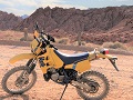
I made a trip from my house south of Wapiti through Fort ala Corne, up to the Torch River and coming out north of Garrick> it was 200 k round trip, about 150 of bush roads and gravel roads. Amazing how much dryer the trails are this year.
The trail starts just north of the bridge ar Wapiti on #6 highway and goes northwest till you cut the diamond mine road, then west a few miles and you pick up another trial that goes northeast eventually coming out on the farmland south of Snowden.
Lots of Sandhill cranes this time of the year
Some of the trail through Fort ala Corne to Snowden
This is the road once you hit the farmland south of Snowden, the beavers have been at work
Then I went up north of 55 till I hit a road that runs along the south edge of the Torchriver and followed it east till a point north of Garrick, you can keep going and pickup Harding road which takes you up to Narrow Hills
The sand ridge along the river was washed up from the heavy flood water last June, washed lots of large pine down as well
Thats what happens when you sit around too long
I first saw this old cabin 20 years ago when it still had lots of personal items in it, now the roof has caved in. It is only about 5 ft high and 8 x 8. A cramped place to spend timewhile on the trapline
Someone else's dream home on the river that did not make it
This is a Torch River crossing that goes up to Wolf Creek, you could do it with a dualsport if the water was a little lower. Have crossed it many times with the ATV
Sign says two way traffic, don't think I would worry about it though
They have tried to grade up the road a bit but it would not be a wet weather road
[imghttps://lh4.googleusercontent.com/-K5yNPNjjqyQ/T7rXtvzvFXI/AAAAAAAABgg/V_DwIjtNyXk/IMG_4391.JPG][/img]
This is the old swimming hole on the river
[imghttps://lh4.googleusercontent.com/-ni3eVIOay9Y/T7rX_UyI5gI/AAAAAAAABg4/dRcRHFBINWY/IMG_4395.JPG][/img]
The end of the trail today, the road is very senic as you follow right beside the river in lots of spots
_________________
I do these things not to escape life but so life does not escape me
|
|
  |
|
 |
|
kiffer
|
Posted: Mon May 21, 2012 10:48 pm |
|
Joined: Sat Apr 07, 2012 6:48 pm
Posts: 1772
Location: S'toon
|
|
Great pics, Snobear! I'll have to try to get up there and ride that with you sometime! Looks spectacular!
_________________
Chris
2017 Versys X
1991 Suzuki TS200R
|
|
| |
|
|
|
snobear
|
Posted: Tue May 22, 2012 7:49 am |
|
Joined: Sat Apr 07, 2012 2:13 pm
Posts: 775
Location: Gronlid (Wapiti)
|
|
Yes there is another section of Fort ala Corne from south of Garrick back to #6 that would make it one big loop so would be a good ride to do if you guys come out from the city one day.
_________________
I do these things not to escape life but so life does not escape me
|
|
| |
|
|
|
kiffer
|
Posted: Tue May 22, 2012 10:27 am |
|
Joined: Sat Apr 07, 2012 6:48 pm
Posts: 1772
Location: S'toon
|
|
Day rides from the city are nice to have in my back pocket, so I'll definitely keep that one in mind!
You said it was 200 km with about 150 km of trail. Might be a good ride for the XR if I trucked it out to your place...
_________________
Chris
2017 Versys X
1991 Suzuki TS200R
|
|
| |
|
|
|
snobear
|
Posted: Tue May 22, 2012 10:59 am |
|
Joined: Sat Apr 07, 2012 2:13 pm
Posts: 775
Location: Gronlid (Wapiti)
|
|
Yes I think it would be great for the XR. Some gravel roads as well but lots of good back country stuff.
_________________
I do these things not to escape life but so life does not escape me
|
|
| |
|
|
|